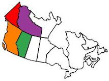
After spending two months in Alaska, our trip south feels as if we are falling out of Alaska through the Yukon and into British Columbia.
We left Valdez, Alaska last week and drove to Tok, Alaska. In Tok we washed the RV (finally, it was a mess), re-visited a favorite restaurant (Fast Eddy's) and spent the night in the Tok RV Campground.

The next day we took off for Chicken Alaska, a small outpost 80 miles off of the 'beaten path' that consists of two campgrounds and a couple of small stores. Chicken got its name from the miner's that were working on gold claims in the early 1900's. They wanted to name it ptarmigan, after the many chicken-like birds that inhabited the area.
No one was sure of how ptarmigan was spelled so they finally settled on a name where they could agree on the spelling: Chicken. So that became the town's name: Chicken, Alaska.

We did see a moose just outside of Chicken. She was standing in a pond and eating the vegetation that grows there, about 30 feet from the road. We watched her for a few minutes before leaving her to her business. Mary Lynn also saw a Lynx however I was too busy driving the RV - go figure. Did I mention the roads, even the mountain roads, did not have guardrails?
We had heard a lot about Chicken and wanted to visit however, if you go to chicken you have to make a decision. Do you back-track the 80 miles and then take the Alaska Highway to Whitehorse in the Yukon Territory or do you proceed on the Taylor Highway and take the Top Of The
World Highway to Dawson City and then (eventually) to Whitehorse?

We had heard a lot, good and bad, about the Top Of The World Highway. Everyone talks about how beautiful the scenery is and about how bad the highway is. Eventually we decided we would take The Top Of The World Highway and just take our time traveling through the last bit of Alaska, through Canadian customs and down into Whitehorse.
Let me tell you; taking an RV over this highway is quite an adventure, especially a class A RV. See, in a class A RV you are in the RV and can hear every bump, sway, bounce, and bang that occurs. In other RV's you ride in your tow vehicle and are (somewhat) isolated from the bouncing and jostling.
In any case, none of the RV's were making record time although the class A's definitely went the slowest. We averaged 25-30 miles-per-hour on this highway and many times, when we hit gravel washboard surfaces we were only able to travel between 5 & 10 miles per hour.

After crossing Canadian customs the road was paved and smooth (you don't always get both) and it felt like we were flying (especially without guardrails). Flying that is for about 10 kilometers. Just as I was remarking about how good the road was and how much faster we were able to travel we hit, you guessed it, gravel roads with washboard surfaces. Some of the worst roads of our trip.

It was pretty cool as we eventually neared Dawson City. From high up on the mountain you suddenly get a glimpse of the Mighty Yukon River and Dawson City. Then you notice Dawson City is on the other side of the Yukon River and there is no bridge.
Turns out the city of Dawson City runs a free ferry across the Yukon - very cool. Especially the free part because at that point you would be willing to pay almost any amount of $$$ to get to civilization rather than backtrack 100's of miles of poor roads. And yes, you can call a town with only 2800 inhabitants 'civilization'....

Dawson City is the town established when gold was discovered on Rabbit Creek. Don't recognize Rabbit Creek? Well the gold miner's didn't feel the name Rabbit Creek didn't quite capture the magnitude of this gold discovery. So they renamed it Bonanza Creek. And the creek above was named Eureka Creek.
Still not sure? How about the Klondike Gold Rush of '98.
The town has done a great job of keeping the look and feel of Dawson City close to the original; not one fast food business in town or along the highway.
After exploring Dawson City for a few days we headed south again with the town of Whitehorse in our sights. Saw a couple of grizzlies along the way although both were some distance away.
Whitehorse is a town of ~ 28,00 so it's quite a bit bigger. We spent two nights there, resting and stocking up before leaving this morning for Watson Lake. We arrived here in Watson Lake around 4 pm and are just getting settled.
Tomorrow we need to choose between staying on the Alcan Highway or taking the Cassiar Highway. Cassiar is again a little more scenic and has section of road that are poor. Not as poor as the Top Of The World Highway but poorer none the less.

Not sure which one we'll take. May ask around to see if any of the fellow RVers here at the campground have just come north on the Cassiar to get a 'real time' update.
I'll give another update when we get to an RV park with Internet.
See Ya!


0 comments:
Post a Comment